
Features · Live Fire Map
A Living Map of Every Fire Incident in the Country
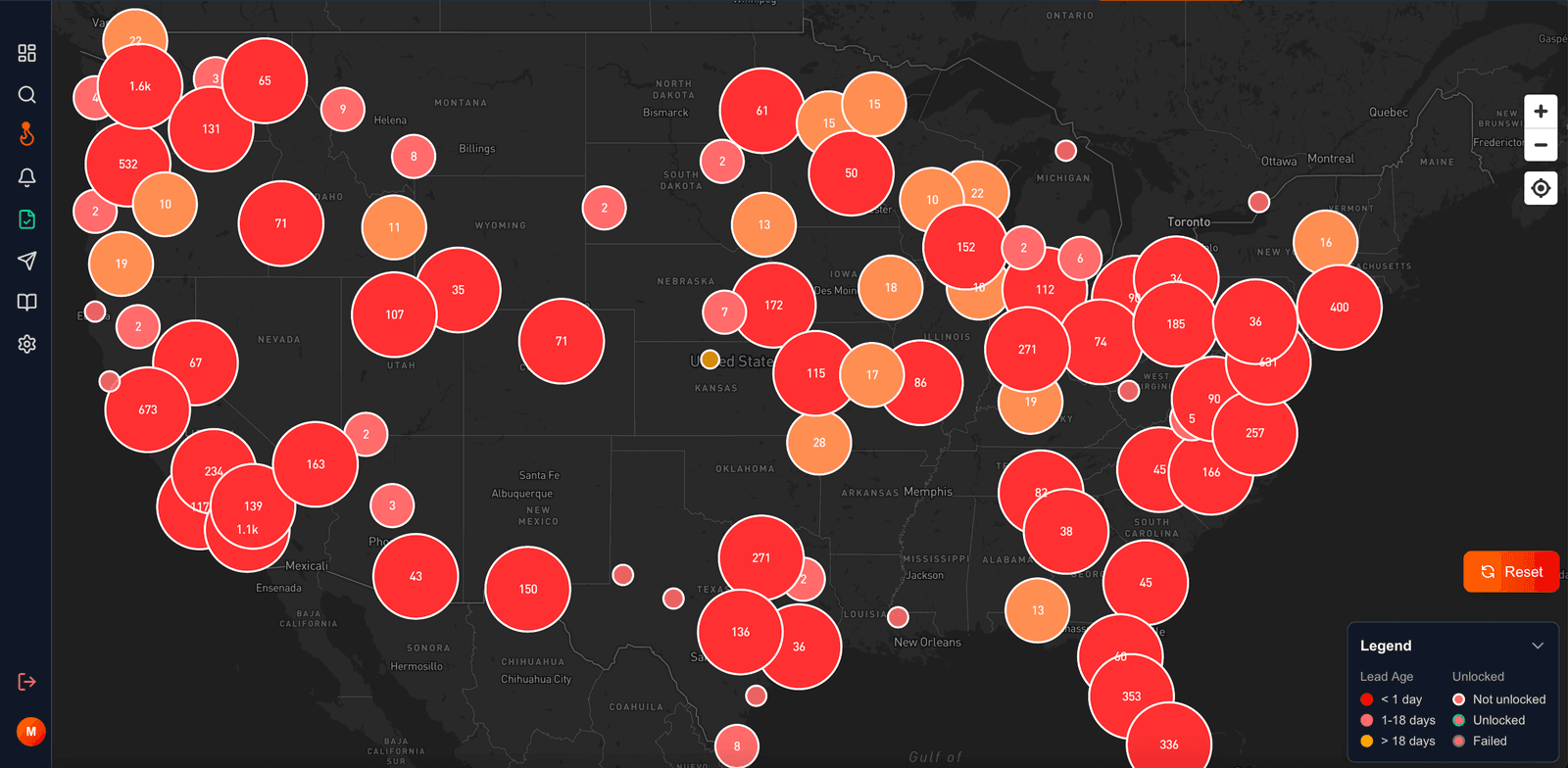
The moment you log into FirstLeads you see fire incidents across the United States on a live map, not a spreadsheet, not a stale list. Pan, zoom, and click from a national view down to a single property.
Quick Answer
When you first land on the dashboard, you see a dark, high-contrast map of the United States with clusters of colored circles, from dense metro corridors on the East Coast to smaller pockets out west. Each circle is a group of fire incidents in that area, and the whole map updates in near real time as new incidents come in.
Navigation works exactly the way you expect: drag to pan, scroll or use the +/− controls to zoom. Zoom into a tight cluster and it breaks apart into smaller groupings until you are looking at individual properties, block by block.
How to read the map at a glance
Circle size and number = incident volume
The number inside each circle is how many incidents are grouped there: "1.6k" means 1,600 incidents, "8" means eight. Bigger circles hold more incidents, and zooming in un-clusters them into precise groupings.
Color = how fresh the lead is
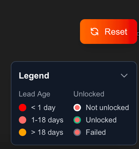
Red means less than 1 day old, the hottest, most actionable leads, fresh off the dispatch feed. Pink/salmon means 1–18 days: still workable, but the first-call window is closing. Orange means over 18 days: worth a look, but expect competition.
Outline = your history with the lead
A light outline means you have not unlocked the incident yet. A green outline means you already claimed it and have full contact and property details. A muted outline flags an unlock attempt that did not go through.
Everything else is one click away
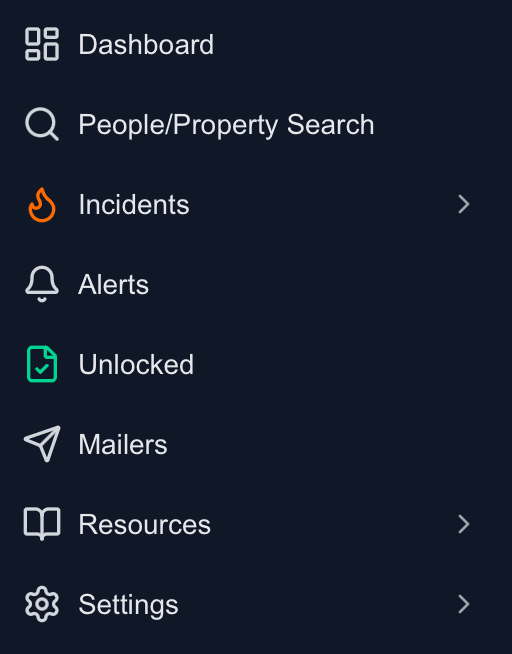
The left-hand menu expands into full navigation: People/Property Search, Incidents, Alerts, your Unlocked library, Mailers, Resources, and Settings, everything between "a fire happened somewhere" and "I have a signed job."
See your territory live
Book a demo and watch fire incidents appear on the map for your county in real time. No contract, no setup fees.
Frequently Asked Questions
Keep exploring
- What you see when you click an incident
- Dialing in your territory with filters
- Set-and-forget alerts for your territory
See everything the platform does on the FirstLeads features page.